Equatorial Guinea
An island and mainland territory opening onto the Atlantic from the heart of Central Africa, combining tropical forests, modern cities and land borders with Cameroon and Gabon.
Equatorial Guinea as host State
Equatorial Guinea welcomes all delegations and participants of ICAN 2026. We are pleased to receive authorities, airlines and representatives of the international aviation sector to share experience, strengthen agreements and create new opportunities for connection. This gathering will let us show the world our infrastructure, our hospitality, our culture and our tourism, reaffirming our commitment to an aviation that is safe, modern and open to the future.
The country in figures
- 28,051km² of national territory
- 1.94 MinhabitantsWorld Bank, 2025
- 37.1%of the population is under 15World Bank, 2025
- 71.6%of the population lives in urban areasWorld Bank, 2025
- 12,823million USD nominal GDPWorld Bank, 2025
- 86.4%forest coverWorld Bank, 2023
- 8provinces, across two regions
- 3official languages
- 5international airports
What awaits delegations
Beyond the figures, six things that matter in practice to a participant: the working language, the season, the distances, the currency, the natural surroundings and the host's readiness.
Three official languages
Spanish is in general use, and French and Portuguese are also official. Most delegations work without a liaison interpreter.
Africa's only Spanish-speaking StateDecember, in the dry season
The climate is equatorial and steady: 25 to 30 °C by day, high humidity but little rain in December. Light clothing is enough, with a jacket for air-conditioned rooms.
25-30 °C in DecemberShort distances
Malabo airport, the hotels and the negotiation venue all sit within about thirty minutes of each other. No domestic travel is needed to attend the conference.
Airport 20 min from the centreA currency pegged to the euro
The Central African CFA franc is pegged to the euro at a fixed rate, which makes conversions immediate and budgets predictable. Cash remains widely used.
655.957 XAF = 1 EURNature on the doorstep
Pico Basilé rises 3,011 m above Malabo, the Luba caldera and Lake Moka are a few hours away, and the Arena Blanca beaches host nesting leatherback turtles.
86.4% forest coverA host country that is ready
Equatorial Guinea has hosted African Union summits and the Africa Cup of Nations. The Sipopo complex, its conference centre and its hotels were built for events of this kind.
AU Summit 2011, AFCON 2012 and 2015
Two regions, eight provinces
The country brings together the mainland region of Río Muni and the islands of Bioko, Annobón, Corisco, Elobey Grande, Elobey Chico and several islets. It is divided into eight provinces: Bioko Norte, Bioko Sur, Litoral, Centro Sur, Kié-Ntem, Wele-Nzas, Annobón and Djibloho.
It is the only sovereign State in Africa where Spanish is an official language in general use. French and Portuguese are also official languages.
A hub in the Gulf of Guinea
The national diversification strategy covers agriculture, fisheries, mining, tourism, information technology, services and industry. For ICAN participants, better air connectivity translates into trade, tourism, investment, academic cooperation and regional integration.
Airport network
Malabo, Bata, Mengomeyén, Annobón and Corisco, with capacity to expand domestic, regional and international services.
Integration
A member of CEMAC, ECCAS, the African Union, OHADA and the African Continental Free Trade Area.
Ports and roads
Ports, the road network, telecommunications and areas such as Luba Freeport complement air connectivity.
CFA franc
The Central African CFA franc (XAF) is pegged to the euro at a fixed rate of 655.957 XAF to 1 euro.
Equatorial Guinea in pictures
The country awaiting the delegations, and what a few extra days would open up.
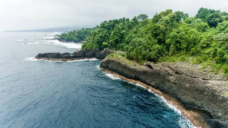
From volcanic Bioko to the Atlantic coast of the mainland, by way of the smaller islands.
Pico Basilé, the Arena Blanca beaches and the island of Corisco are all within reach of Malabo. Step 4 of the guide explains how to arrange it.